Low bridge GPS: warned before the bridge, not under it
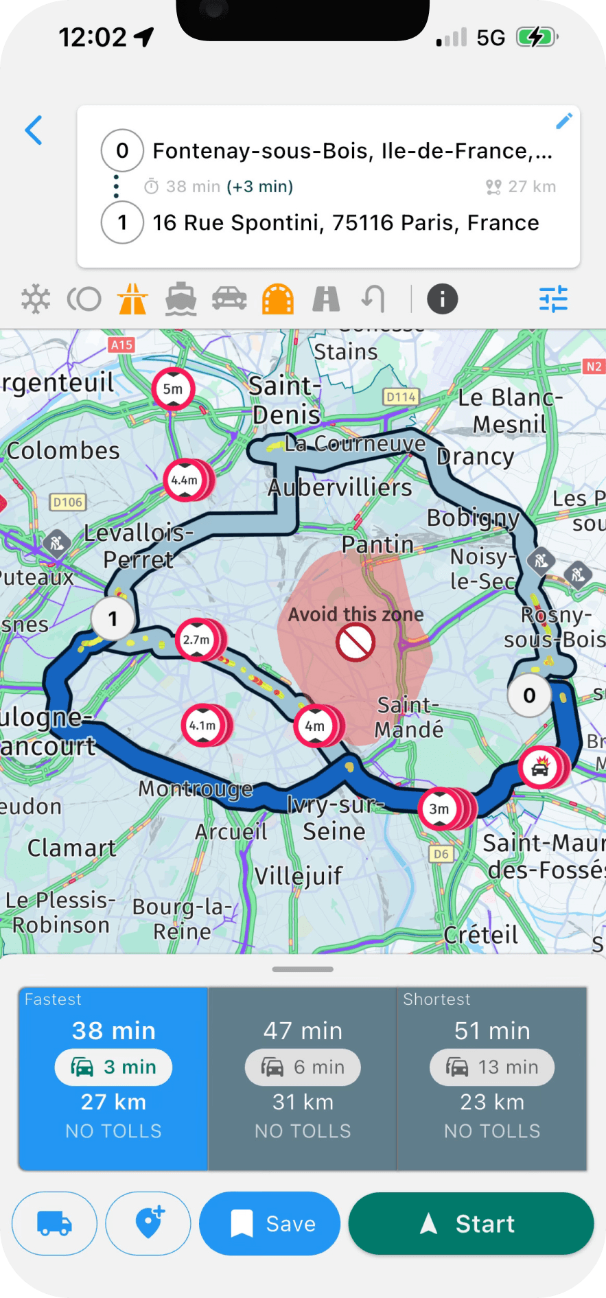
Navitruck plans routes around every bridge lower than your vehicle and warns you before each one — including when you are off-route and the app is in the background. Add your own avoid zones for the bridges and streets you never want to see again.


3-day free trial on the web · 7 days in the app · Cancel anytime
Why bridge strikes keep happening
A bridge strike rarely comes down to a driver who did not care. It comes down to a route from an app that did not know the vehicle's height, a sign that was obscured or missed, or a detour onto a road the plan never covered. The damage is not limited to the trailer: rail lines are stopped for inspection, roads are closed, and the fine and insurance consequences follow the driver.
The fix has two parts. The route has to be calculated for the real height of the vehicle, and there has to be a warning that works when you are not on that route.
Start with your height, measured properly
Navitruck's routing uses the height in your vehicle profile against the clearance data on the map. Measure the vehicle at its tallest point in its normal loaded configuration: roof-mounted units, exhaust stacks, aerials and high-cube trailers all count. If the height varies with the load, use the tallest case. A profile that is a few centimetres too low is worse than none, because it gives you a route you trust for the wrong vehicle.
An alert before the bridge — even in the background
Routing alone does not cover the moments when strikes actually happen: a closure that pushes you onto side streets, the search for a customer's gate in an industrial estate, or a short hop across town with no destination set. Navitruck keeps comparing the road ahead with your profile while the app runs, in the foreground or behind another app, and gives you a sound and on-screen warning early enough to stop or turn.
- Works with or without an active route
- Keeps running with the app in the background
- Uses the same offline map data, so it does not need signal
Avoid zones for the places you already know
Some hazards are local knowledge rather than map data: a bridge that is signed correctly but always tight, a town-centre street with a camera-enforced ban, a depot approach with an awkward turn. Navitruck lets you draw your own avoid zones on the map. Routes are calculated around them, on top of the restriction avoidance that comes from your profile.
Built for trucks, coaches and RVs alike
Low bridges are not only an HGV problem. Coaches, double-deckers, motorhomes and cars towing tall caravans are all struck every year. Navitruck uses the same height-based routing and background alerts for every vehicle type, alongside weight, width, length, hazmat and tunnel restrictions, offline 3D maps for every region, lane guidance and speed cameras.
Common questions
How far before a low bridge does the alert come?
Early enough to act. The warning is given as you approach a bridge that is lower than your profile height, before you reach it, with a sound and an on-screen message. The exact distance depends on your speed and the road, so treat the alert as an instruction to slow down and check, not as a last-second warning.
Does it work if I have not set a destination?
Yes. Background alerts compare your position and heading with the restrictions ahead as long as Navitruck is running, whether or not a route is active and even when the app is behind another app.
What if the bridge is not in the map data?
Restriction data is extensive but no database is complete. Keep your height correct, read the signs, and use custom avoid zones for the bridges and streets you know are a problem so they are never routed through again.
Does it work offline?
Yes. Clearance data is part of the downloadable offline maps, so routing and low bridge alerts work without a data connection. All regions are included in Premium.
Never reverse out from under a bridge again
Height-based routing, an alert before each low bridge and your own avoid zones, offline, on iOS and Android.
3-day free trial on the web · 7 days in the app · Cancel anytime
More about Navitruck
- Truck GPS appRestriction-aware navigation for trucks and HGVs.
- Hazmat & tunnel routingADR-aware routes that respect tunnel categories.
- Offline truck maps3D maps for every region, downloadable at no extra cost.
- RV & caravan GPSNavigation that knows your motorhome's height and weight.
- BlogGuides on vehicle profiles, bridge strikes and background alerts.